
Waterbury ZIP Code Coverage
The current USPS DMM L606 table groups Waterbury preferred-city mailing assignments under three lead rows. The range notation includes both ordinary delivery codes and codes that should not be treated as neighborhood polygons. Connecticut's post-office list adds the named stations and branches. Read the two official sources together: USPS controls the preferred mailing form, while the state list shows the office name and its listed town.
| Postal row | ZIP assignments shown | Waterbury office context | Research note |
|---|---|---|---|
| WATERBURY CT 06701 | 06701–06702, 06706, 06708, 06720–06726 | Main Waterbury; Brass City Annex is listed at 06708 | Preferred-city grouping, not a municipal boundary |
| WATERBURY CT 06705 | 06703, 06705, 06716 | East End and Lakewood are 06705; Wolcott Branch is 06716 | Branch name, ZIP, and town line must be checked separately |
| WATERBURY CT 06704 | 06704, 06710 | Plaza Station is listed at 06704 | Use address-level USPS validation for a specific property |
| Prospect Branch | 06712 | State list places the branch in Waterbury | Not in the current DMM WATERBURY preferred-city rows cited here |
This Waterbury ZIP code directory does not assign each code to a neighborhood without evidence. East End and Lakewood share 06705 as post-office listings, while Prospect and Wolcott branch names complicate any quick assumption about town identity. A mailing-city row tells the sender how an address is formatted; it does not establish the parcel's taxing authority, voting district, or neighborhood association.
Waterbury ZIP Code Post Offices
The Connecticut post-office list names main Waterbury at 06701, Brass City Annex at 06708, East End and Lakewood Station at 06705, Plaza Station at 06704, Prospect Branch at 06712, and Wolcott Branch at 06716. These names are postal access points, not proof that every address with a related label falls inside the city line.
The state listing captured below is useful because it preserves the branch vocabulary that may appear on letters, forms, and local references.
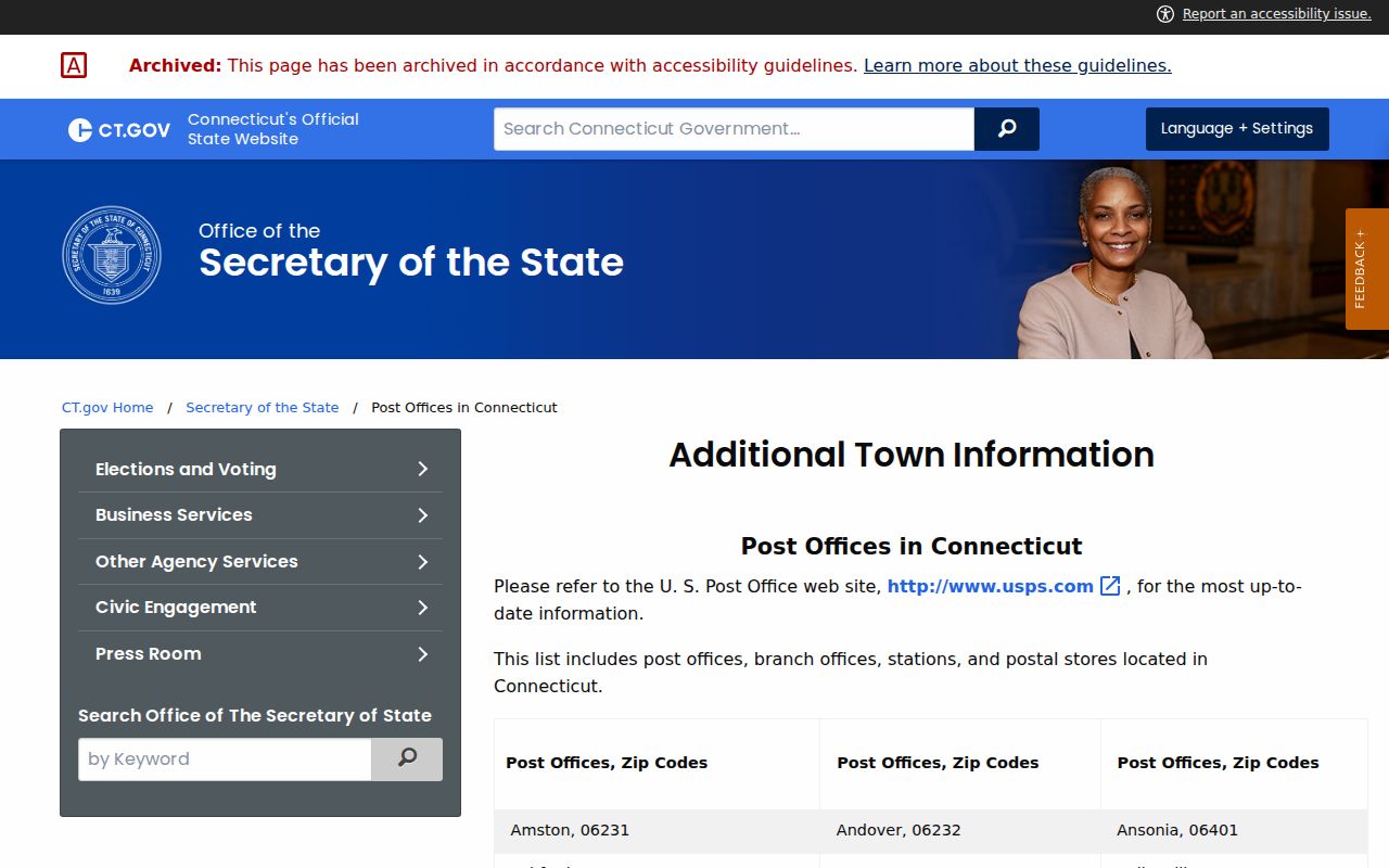
Compare the listed station with the current USPS preferred-city row before normalizing an address for a directory or record search.
Waterbury ZIP Code 06712
Prospect Branch is the clearest local reason not to flatten office location and postal coverage into one map. The state list describes it as a branch in Waterbury with 06712, yet the current DMM rows cited in the research do not place 06712 in the WATERBURY preferred-city set. For a specific envelope or parcel, follow the current USPS result rather than the branch name alone.
Postal comparison. A branch can sit in Waterbury while its ZIP and preferred mailing city describe a different service geography.
This distinction also prevents bad record joins. Waterbury GIS searches parcels by owner, house number, street, or MBL. A validated postal address can guide the search, but the ZIP itself is not the parcel key.
Waterbury ZIP Code 06749 History
An archived USPS DMM table once included 06749 with Waterbury, while the current rows no longer do. That difference is an interest-layer quirk with practical value. A historical letter, directory notation, or family paper may have been correct for its own date even though its postal form fails a current check.
Preserve the original string and source year in research notes. Then obtain the modern result separately. Replacing the old code without a date label can erase useful evidence about when the document was created or mailed.
Find Waterbury Residents by ZIP
There is no inspected Waterbury portal that returns a complete resident roll from one postal code. USPS validates the address; GIS and eQuality then connect a street or parcel key to property records; the voter route serves its own regulated purpose. This sequence is more accurate than treating a ZIP code directory as a list of every person who lives inside an imagined boundary.
- Enter the full street address in the official USPS lookup and save the standardized city, state, and postal result.
- Search Waterbury GIS by house number and street, or eQuality by Location, Street, MBL, or owner.
- Use the parcel MBL to confirm city jurisdiction and inspect the source date rather than inferring it from mail alone.
- For voter information, use the Secretary of the State's official status path or contact the Waterbury registrars.
Once the postal search yields a street, the Waterbury streets page explains the address and parcel workflow in more depth. This page stays focused on the postal layer and its limits.
Validate a Waterbury ZIP Code
The USPS ZIP Code Lookup is the official address-level route. The live form fields did not render during research, so no exact button names or result layout should be assumed. Enter the address using the current tool and keep its response with the date searched. The DMM row remains the broader preferred-city reference.
| Source field or key | Present in inspected source | Best use |
|---|---|---|
| Street address | USPS lookup route | Validate a specific mailing form |
| Owner, house number, street, MBL | Waterbury GIS | Find the municipal parcel after postal validation |
| Location, Street, Unique ID | eQuality property cards | Open assessment details |
| ZIP | Not visible as a GIS or eQuality primary filter | Do not promise a citywide ZIP query |
This captured USPS address lookup is the right starting point for present postal validation.
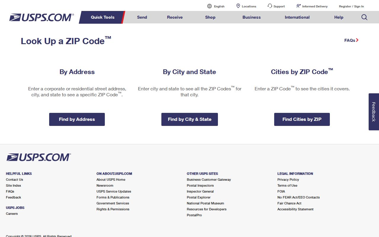
After USPS returns the mailing form, municipal records can answer the separate question of whether the parcel is within Waterbury.
Waterbury ZIPs and Neighborhoods
The city NABES map combines neighborhood labels, ZIP information, and a street-index grid, but it reflects a 2000-era context. It can orient a search around Brooklyn, Bunker Hill, East End, Town Plot, Waterville, and other local names. It should not replace the current USPS response or a parcel search.
Waterbury's other map layers draw voting districts, public-works districts, recycling and refuse routes, drainage basins, wetlands, flood zones, zoning, vacant land, and land use. Each boundary answers a different civic question. A neighborhood association and a postal zone may overlap without matching, and both may differ from a historic street section.
Record Waterbury ZIP Evidence
A clean ZIP code directory note keeps the source forms separate. For current mail, record the exact address entered, the standardized USPS response, and the lookup date. For a parcel, add the GIS address, MBL, owner label, and update notice. For old mail, preserve the original postal wording before noting any present equivalent.
Useful address record
Current: source address → USPS preferred city and postal code → Waterbury MBL → source date.
Historical: document year → original street and postal notation → cross-street clue → verified modern match, if found.
This format prevents a branch-office label from becoming a false neighborhood claim. It also makes later changes visible instead of silently overwriting the evidence.
Waterbury ZIPs Versus City Limits
A postal assignment routes mail; it does not certify municipal jurisdiction. The Waterbury preferred-city rows, branch list, NABES map, and GIS layers are related sources with different purposes and dates. Validate the postal form with USPS, then confirm the parcel in Waterbury GIS or through the Assessor. This is especially important around Prospect and Wolcott branch references and whenever a record uses an old mailing code.
- ZIP vs ZIP+4
- The five-digit code identifies a delivery area; the added four digits narrow delivery further for a specific address or group.
- PO-box ZIP
- A code used for post-office boxes rather than a mapped residential neighborhood.
- Unique ZIP
- A code assigned to one high-volume organization, which should not be read as a normal city district.
- Carrier route
- A delivery path within postal operations, not a city, parcel, voting, or neighborhood boundary.
The directory test is simple: if the question concerns mail, USPS controls; if it concerns city ownership, taxes, voting, or services, use the public office responsible for that record.